Motorcycle Trip Ely, NV through Great Basin to Richfield, UT 2019-06-03
 A playlist of all of the videos from the ride from May 30 thru June 14th.
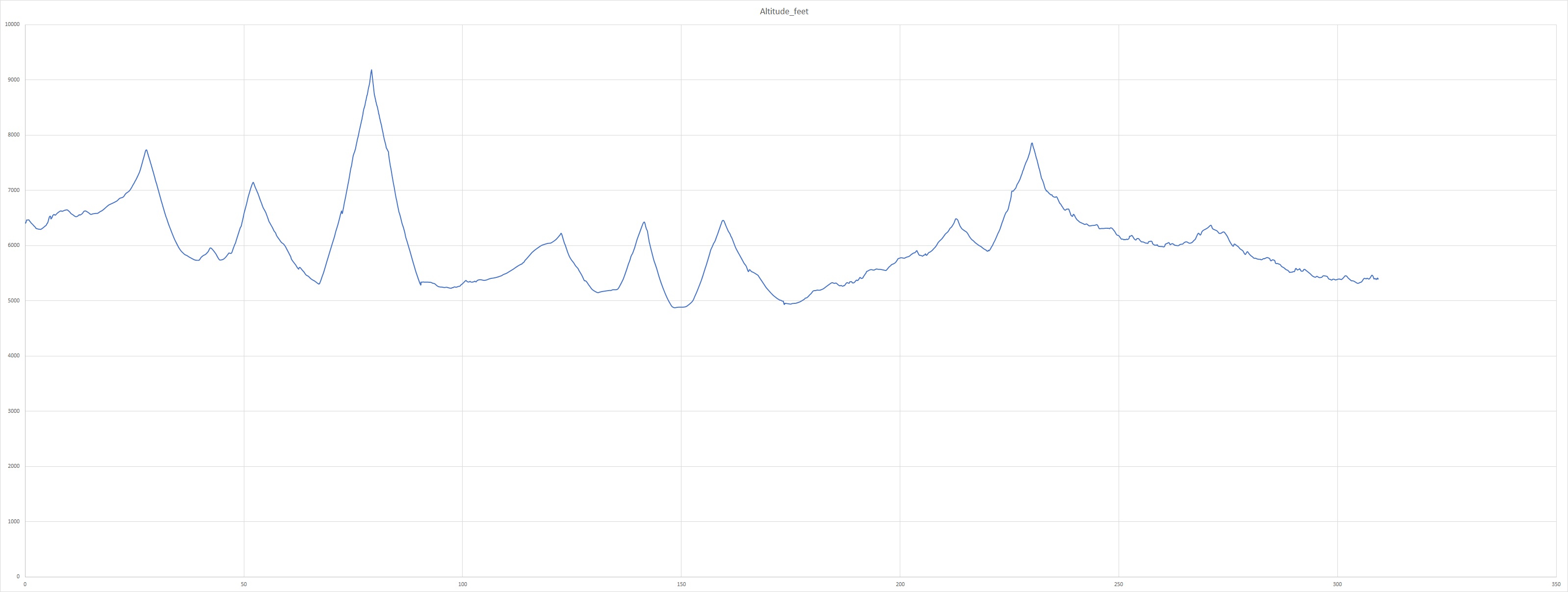
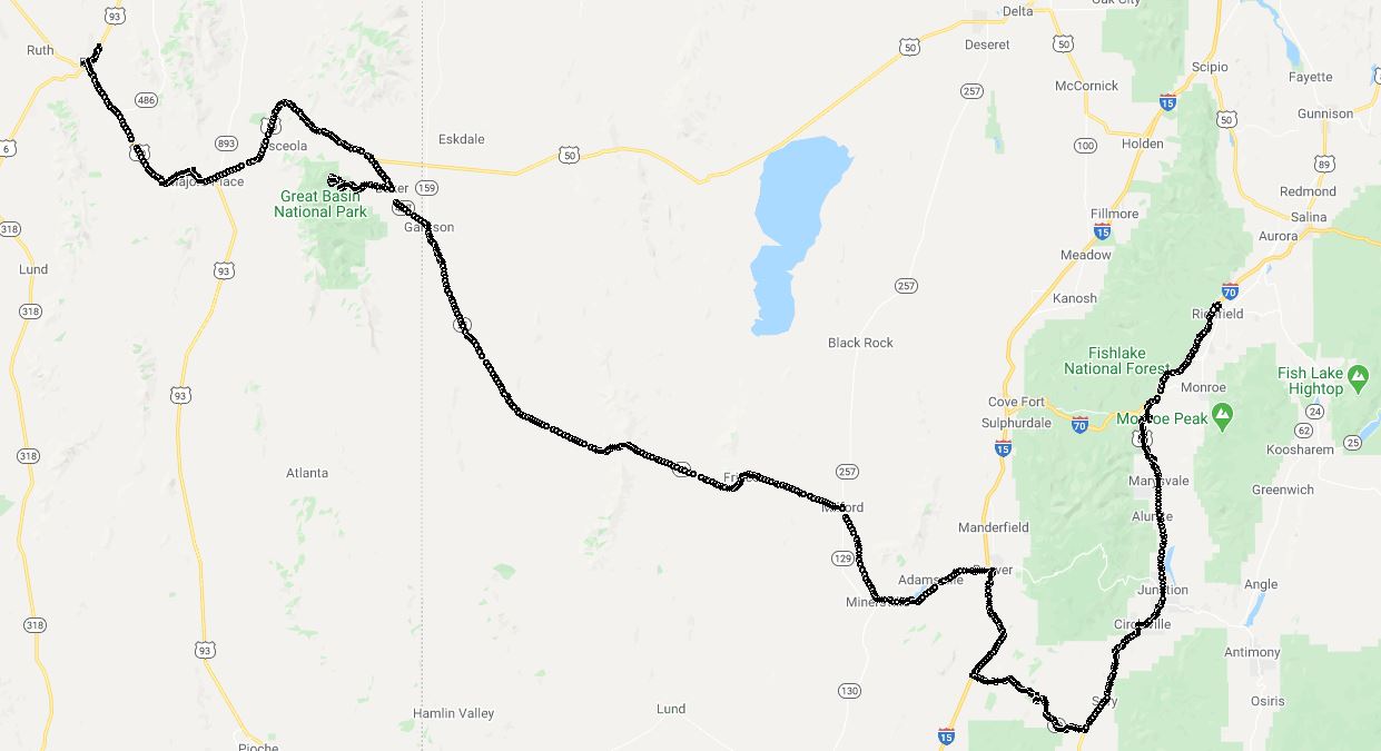
We started our ride from Ely, NV. We looked at the weather forecast the night before and saw that there might be storms, kept that in the back of our minds. Another ride to remeber to take breaks for altitude adjustment. You start at 6,000+ feet and go up to 9,000+ feet, down to about 5,000 feet and end up back at 6,000+ feet. Take breaks when you can.
America's Lonesome Park and Lonesome Highway
Our first destination was the Great Basin National Park. The basin is an area of the county where none of the rivers reach the sea, among other facts about the park. This national park is not visited by large amounts of people so you can escape the crowds. The visitor center has, of course, a huge amount of information about the peak. And another pin for my jacket :-) ...
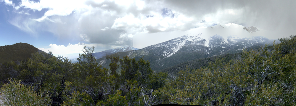
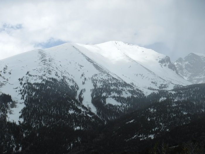
We decided to ride to Wheeler Peak as far as we could go, up to Mather Overlook. You can see us getting to Mather Outlook in this video and the beautiful mountains that surrounded us. The second part of the vidoe is the ride down. Snow all around us on the sides of the road. At this point the sun was mostly up but since we were at 9,000+ feet it was still chilly.
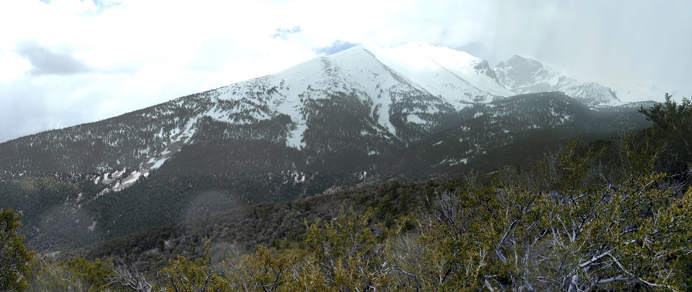
Looking down into the valley that we had just come up:
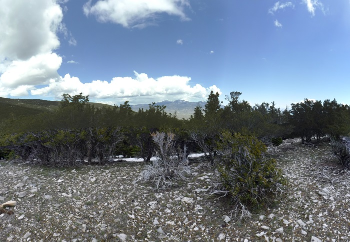
Some of the peaks that were around us:
We journeyed back down the slope to the town of Baker looking for lunch. There was only one place to eat that was open so that was settled pretty quick. Highway 21 between Baker and Beaver UT is a another long relaxing stretch of highway. If you thought Highway 50 was a 'lonesome highway' on Highway 21 we didn't see another car for upwards of 15 or 20 minutes at a time, speed limit was 65 MPH so this covers at least 15 or so miles. You can see in the video that the road was a little rough as the video jumps around.
We continued on to Milford, UT and Beaver UT and took breaks. Again, since you are in the American West get gas and take a break when you can. You don't always know when the next place will be. When we got to Beaver UT it was time for another break and a good time to reassess the weather. The weather north was looking wetter and colder, we had looked at Highway 153 but it is not a paved road and sometimes closed, so highway 15 south and highway 89 north looked like a good option. In the end this was probably a good decision as we saw storms to the nor of us the entire time.
Most of the sunshine by that time had left. Clouds. Rain Clouds. Mixed bag. Cold. As you can see from the below elevation we were higher in the mountains. I provided a winbreak and (small) source of heat for this part of the ride.
We arrived in Richfield NV and settled in for the night.
Motorcycle Trip To The Moab
Any questions or comments send me e-mail
Username = "GandalfDDI"
E-Mail = "Outlook.Com"
Obviously to send me e-mail just put the preceding two together --> Username@E-Mail (this is to minimize the amount of SPAM I get thank you)
Elevations for this ride so you can predict how cold you may get or if you may need to take breaks for altitude changes. Y Axis is altitude feet, X Axis is Miles travelled: