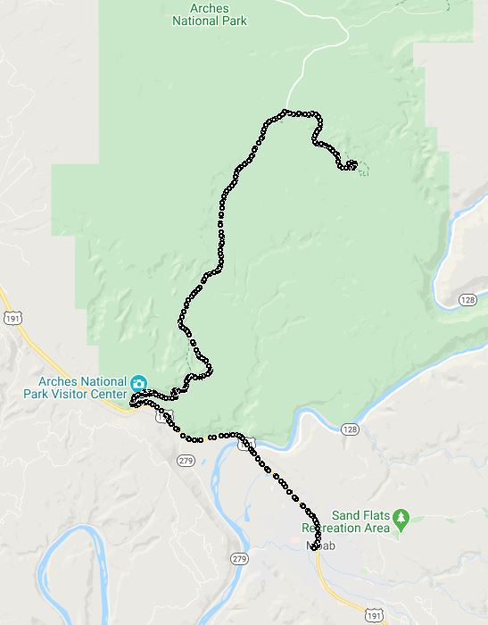
Visit To Arches National Park to the Double Arch Trail and Windows Loop Trail 2019-06-12
 A playlist of all of the videos from the ride from May 30 thru June 14th.
The Arches Double Arch Trail and the Windows Loop Trail are VERY crowded. Easy access to everything. Several different arces to look at. Lots of people. If you want contemplation alone time get there VERY early (sun up) or VERY late so that the families are gone. Otherwise to wipe people out of your pictures you will need photo editing software like GIMP.
The drive to Double Arch Trail / The Windows / Turret Arch / The Parade Of Elephants (now you see why it is crowded) is very short. Because it is popular parking is not easy ... Unless you have a motorcycle ;-) ... Then you can usually squeeze in somewhere.
We walked the short distance to the Double Arches. LOTS of people but we still got some good pictures:
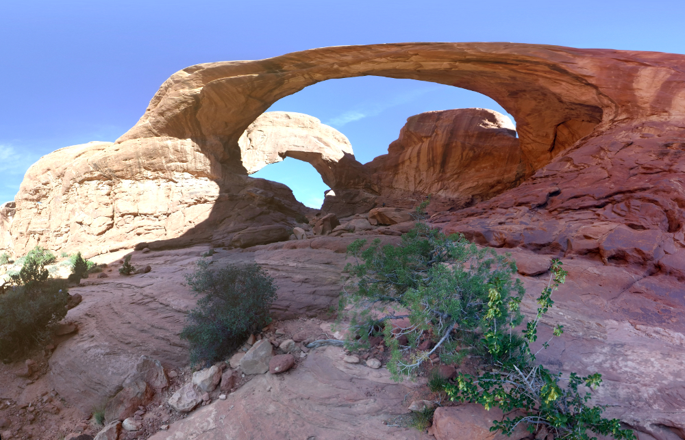
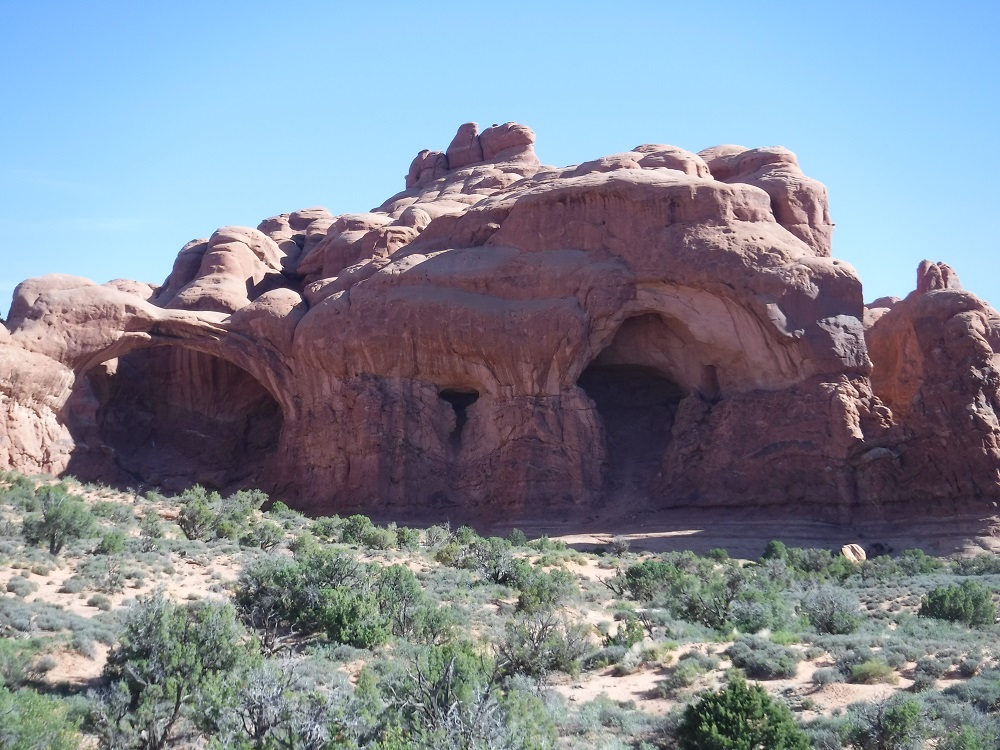
We then took the Primative trail around the back side of Windows to take the path less travelled, most people just take the path directly to the Windows. Closeup of one of the arches on the Primative Trail:
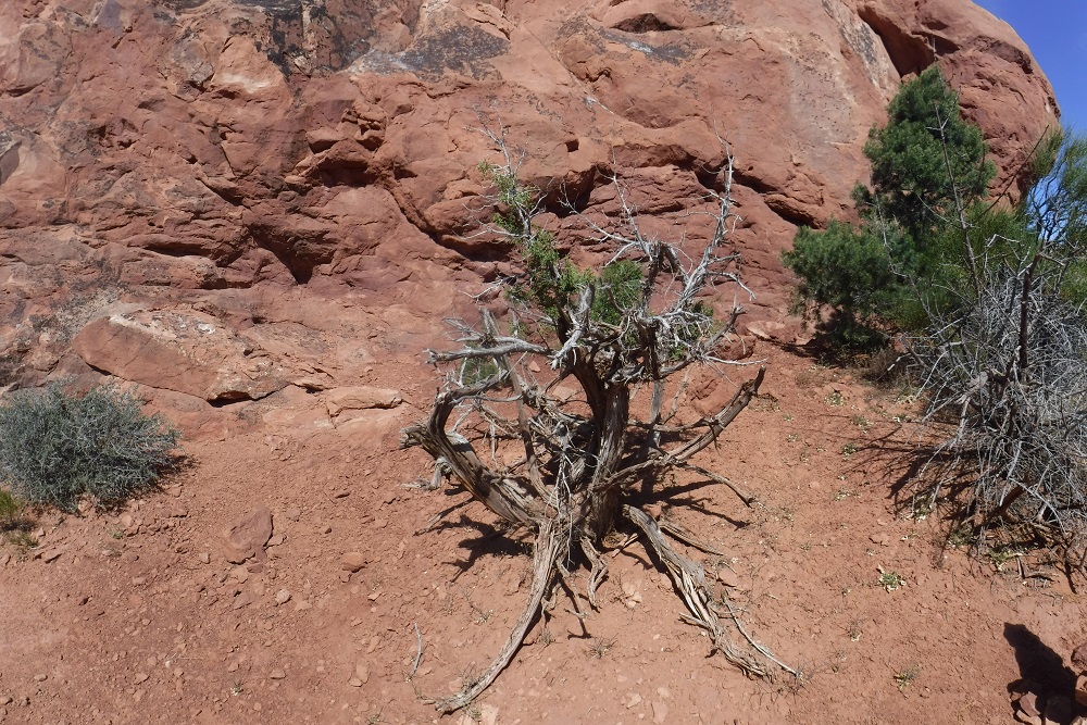
One of the small trees that grows in amazingly bad conditions yet has its own special shape:
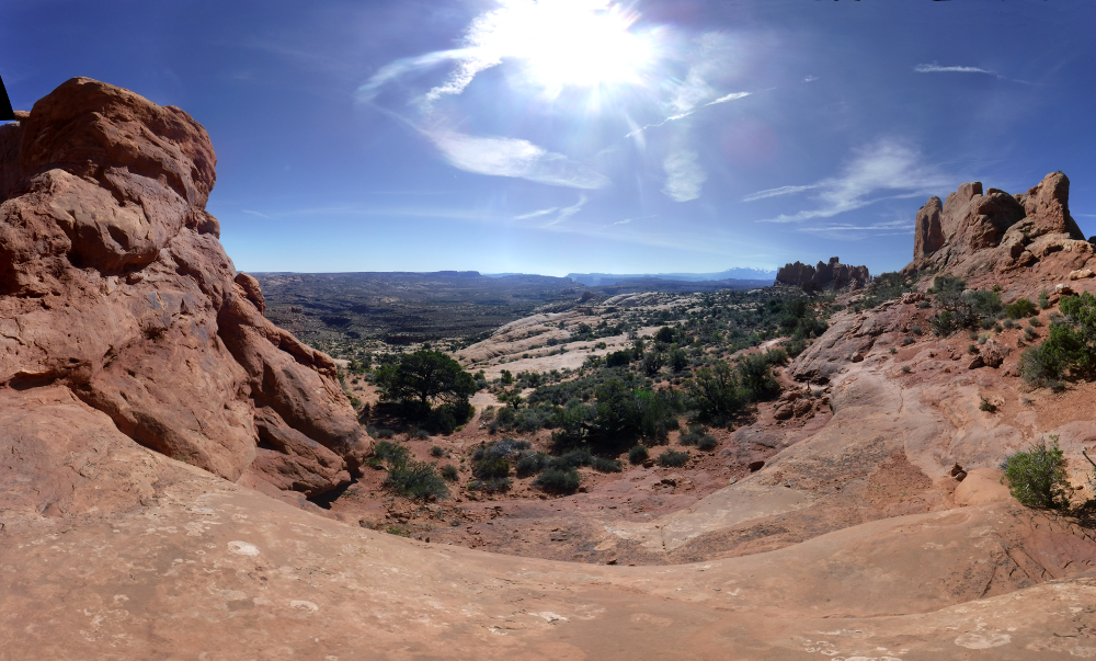
And be sure to look out on the spectacular scenery tat unfolds away from the Arches:
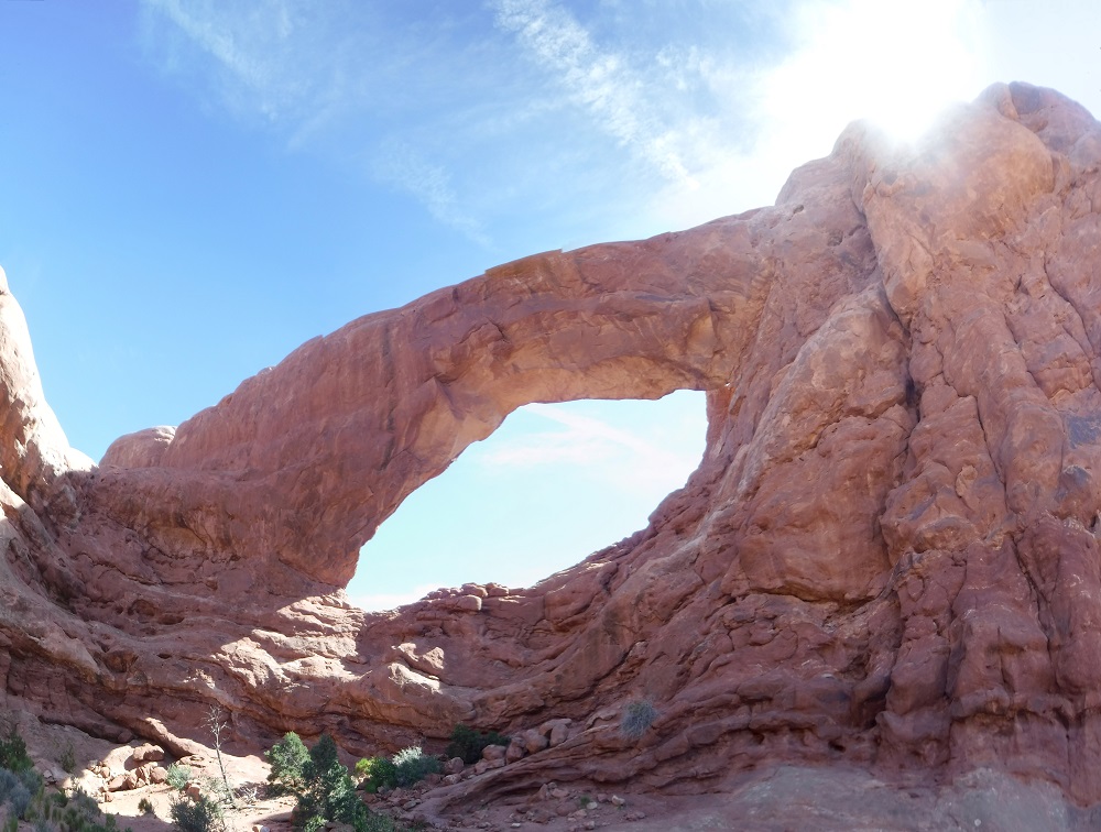
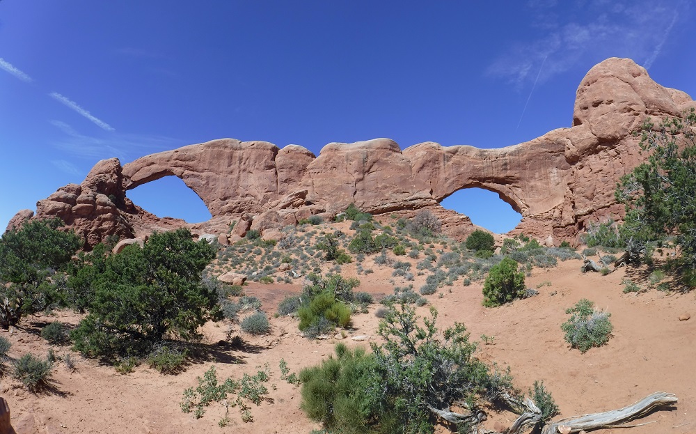
And the Windows part of the arches in one picture:
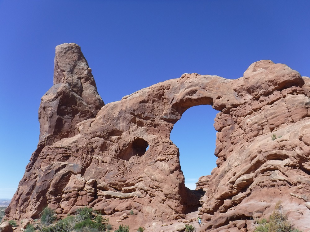
As you are finishing the Windows Primitive trail then go past the Turret Arch:
Another good rock formation is the Parade Of Elephants:
Leaving the Windows Trail we drove around some nice rock formations and went past Balancing Rock in this video. A little further down the road we exited the park into the twisties in this video that you get to take every day, as seen from the pillion.
From there we went back to Moab to our hotel.
Motorcycle Trip To The Moab
Any questions or comments send me e-mail
Username = "GandalfDDI"
E-Mail = "Outlook.Com"
Obviously to send me e-mail just put the preceding two together --> Username@E-Mail (this is to minimize the amount of SPAM I get thank you)
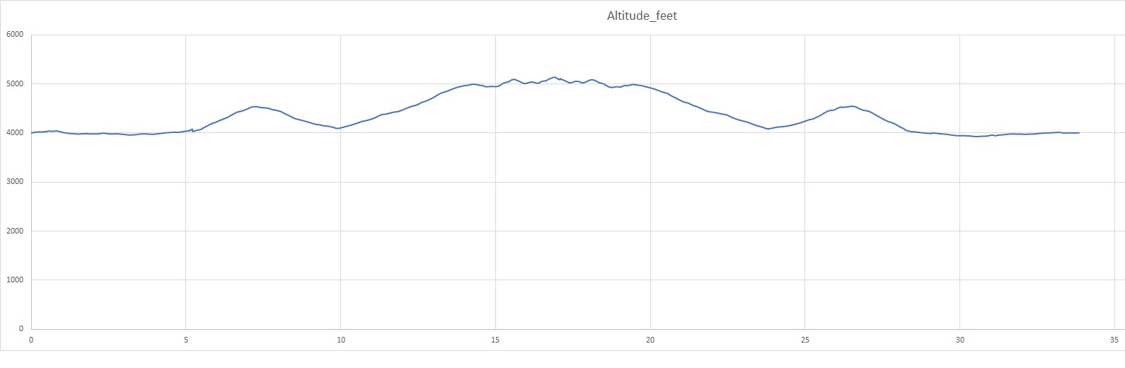
Elevations for this ride so you can predict how cold you may get or if you may need to take breaks for altitude changes. Y Axis is altitude feet, X Axis is Miles travelled: