Motorcycle ride on Washington State Mountain Loop Highway, the southern route 2023-08-06
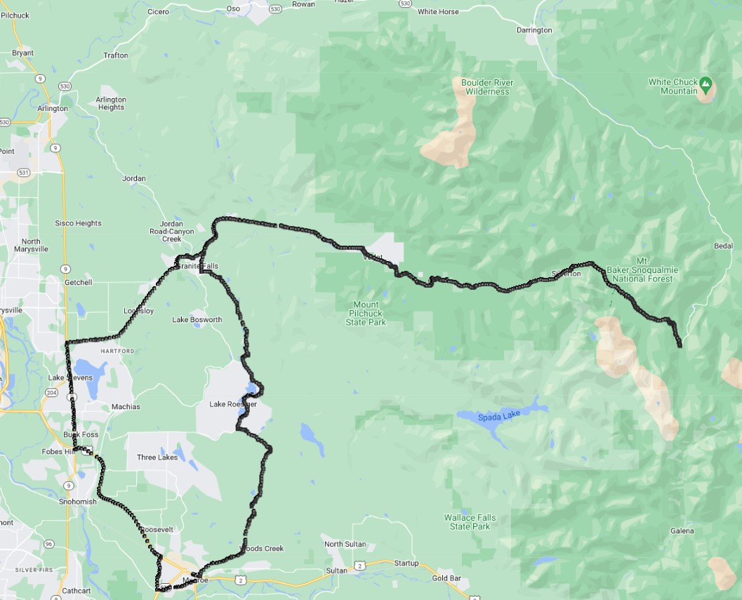
Rode on the Mountain Loop Highway, is an old wagon road that was partially paved in 1936. This ride took me on the southern portion of the paved road right up to the section (Barlow Pass) where the unpaved part starts. The part of the highway that goes almost directly north from where I stopped is gravel road / one lane for 14 miles. Bing Maps has a streetside view of the northern part of the road where the road turns from two lane to one and starts getting rougher heading south. Maybe one day I will go south from Darrington & see how far I can get on this part of the road.
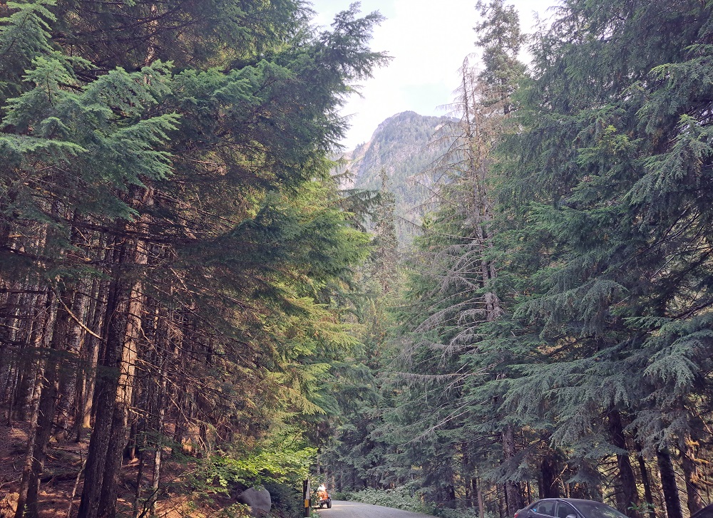
For this ride the views are very nice. The traffic on the road was fairly light for a Sunday. This is a picture looking where the unpaved road starts, this is near the Barlow Pass Trailhead:
This is the video of the ride from Monroe, WA to the Barlow pass trailhead and back.
Motorcycle Trips
Any questions or comments send me e-mail
Username = "GandalfDDI"
E-Mail = "Outlook.Com"
Obviously to send me e-mail just put the preceding two together --> Username@E-Mail (this is to minimize the amount of SPAM I get thank you)
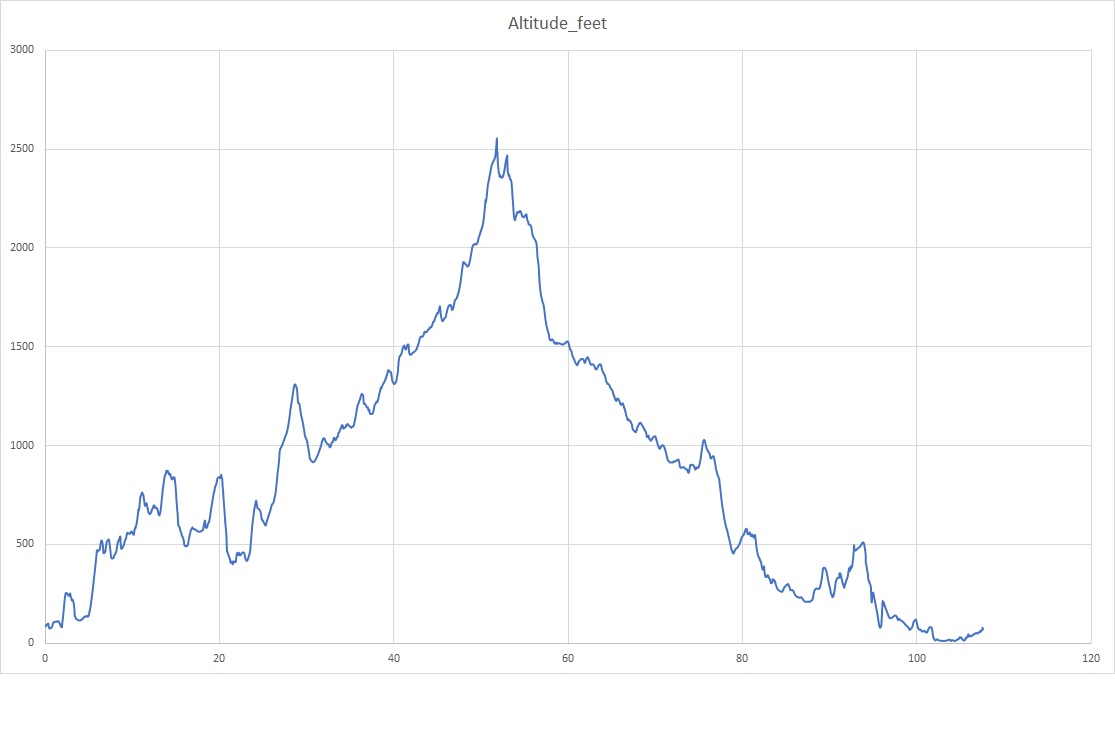
Elevations for this ride so you can predict how cold you may get or if you may need to take breaks for altitude changes. Y Axis is altitude feet, X Axis is Miles travelled: