Motorcycle ride around Orcas Island 2023-06-03 and 2023-06-04
Went to Orcas Island, one of the San Juan islands in the Puget Sound. The only way to get to Orcas Island is via the Washington State Ferry System. Since I was riding a motorcycle all I had to do was look at the schedule and figure out when I wanted to go. Motorcycles are always allowed on / load first, no need for a reservation. Wa Ferries reserves the right not to load Motorcycles first / without reservations but I have always been loaded on first, never sit in line just ride up to the dock. If you are going with a car they should make reservations as this ferry is crowded on the weekends.
Stayed at the Rosario Resort and Spa. The family that owned quite a bit of that part of the island donated land for the Moran State Park. This is a nice resort, lots of amenities. It was a normal hotel room with a bed, no kitchen / cabin type accommodations.
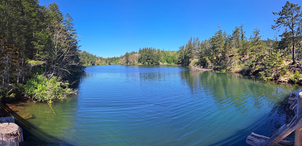
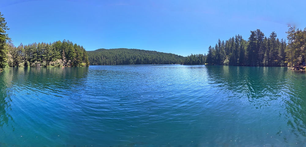
Up the hill (along a very steep path) from the resort was Cascade Lake, nice hike once you get up the hill. Lots of shade, signs pretty well direct you how to stay on the path around the lake:
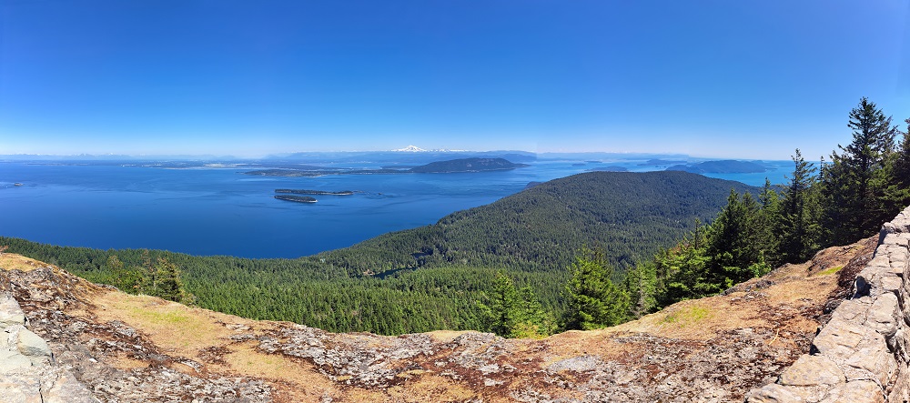
Drove up to the top of Mt Constitution. AMAZING view of the Puget Sound. You can hike up the 1,500 ft 6.7 mile trail or drive up to the peak:
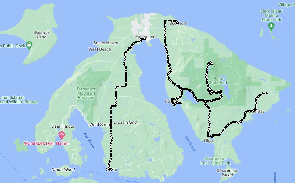
Rode my motorcycle around the eastern half of the island. First to the far eastern part, up then back down the road to Mt Constitution, over to the middle part of the island then back to the resort. This is the video of the ride around the island:
Ride around Orcas Island.
After the ride visited Twin Lakes trailhead (trail from Mountain Lake to Twin Lakes), nice short hike on Mountain lake before heading for the ferry. Easy to get to it is the first turnoff to the right going up to the Mt Constitution summit:
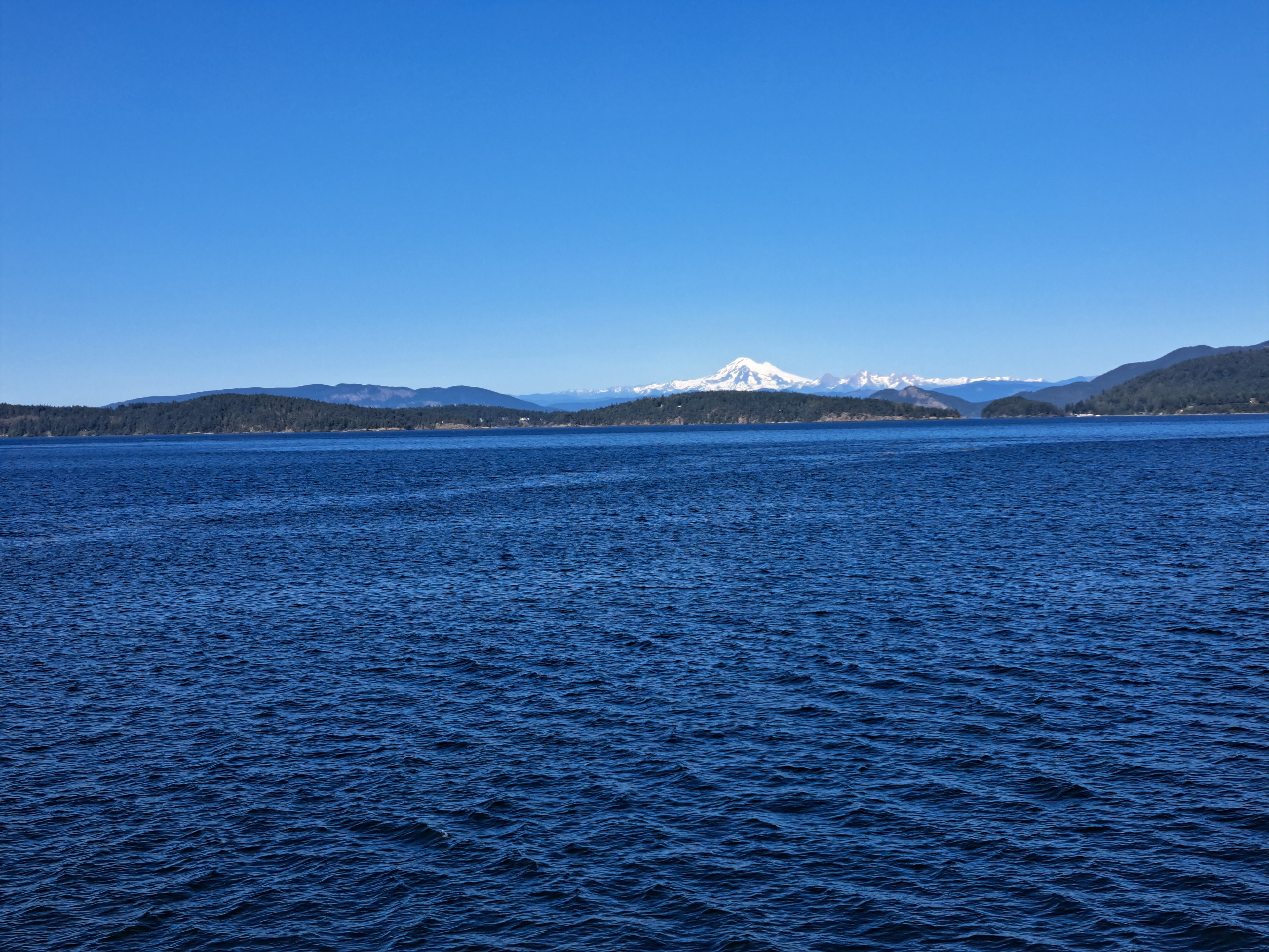
Heading back to Anacortes on the ferry Mt Baker comes up in view:
Motorcycle Trips
Any questions or comments send me e-mail
Username = "GandalfDDI"
E-Mail = "Outlook.Com"
Obviously to send me e-mail just put the preceding two together --> Username@E-Mail (this is to minimize the amount of SPAM I get thank you)
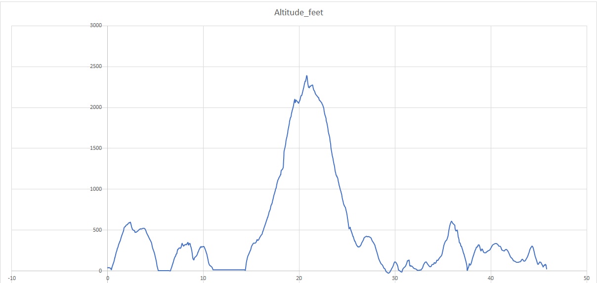
Elevations for this ride so you can predict how cold you may get or if you may need to take breaks for altitude changes. Y Axis is altitude feet, X Axis is Miles travelled: