Motorcycle Ride around Newport, OR October 03, 2021
 A playlist of all of the videos from the ride from October 2 thru October 8, 2021.
Decided to take a day off the road and do a long walk on the beach. After the walk go out on a ride and enjoy riding in the local scenery in the hills.
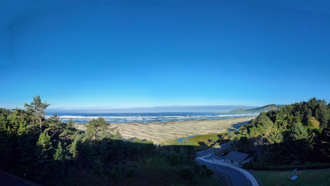
The beaches on this part of the west coast are generally very wide and easy to walk if you can go down to them. A nice mix of rocky shores and long wide sandy beaches. The beaches drop off so slowly that you can wade out for some distance, but to swim you need a dry suit. COLD water because of the North Pacific Gyre, this gyre brings in clode water all along the west coast from the arctic. This is a day time shot of Agate Beach:
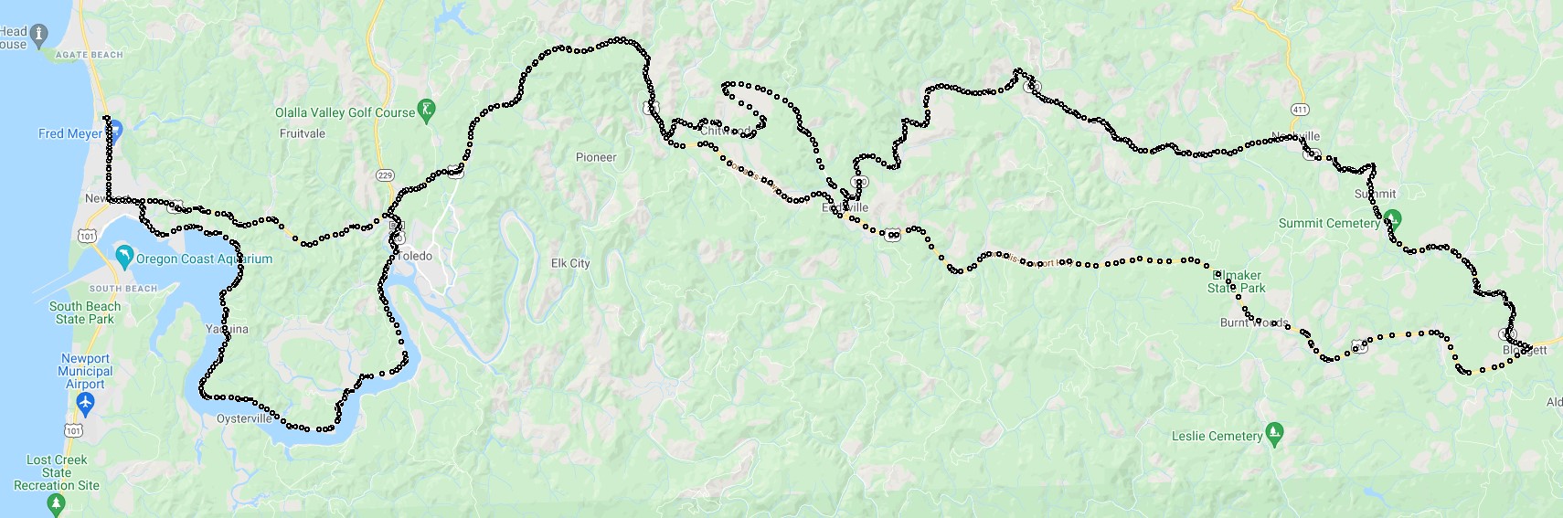
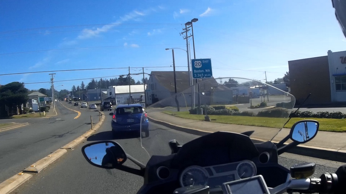
After walking on the beach we rode up into the hills around Agate Beach. Started out on US Route 20, 'the longest Interstate Highway in the U.S.' (might ride that one day):
Went down highway 20 to Crystal Creek Lane (as you can see on the map). A video of riding through the hills, The roads are VERY nice, newly paved / clean. The width was fine for me but might have been a *little* close if two cars had to pass at some points.
At the end of the route through the hills was the Blodgett Country Store. Stopped and got a HUGE ice scream 'one scoop' treat. A couple of other bikers stopped there also. Has all your needs :-).
Back on highway 20 towards Agate beach was a turnoff to a route that went along Yaquina Bay. Beautiful sunshine ride, this is a video along the river, nice quiet ride.
From Yaquina Bay back to Agate Beach for the night to get ready to go to Crescent City / the Redwood Forests.
Motorcycle Trip From Washington down Highway 101 to the Redwoods
Any questions or comments send me e-mail
Username = "GandalfDDI"
E-Mail = "Outlook.Com"
Obviously to send me e-mail just put the preceding two together --> Username@E-Mail (this is to minimize the amount of SPAM I get thank you)
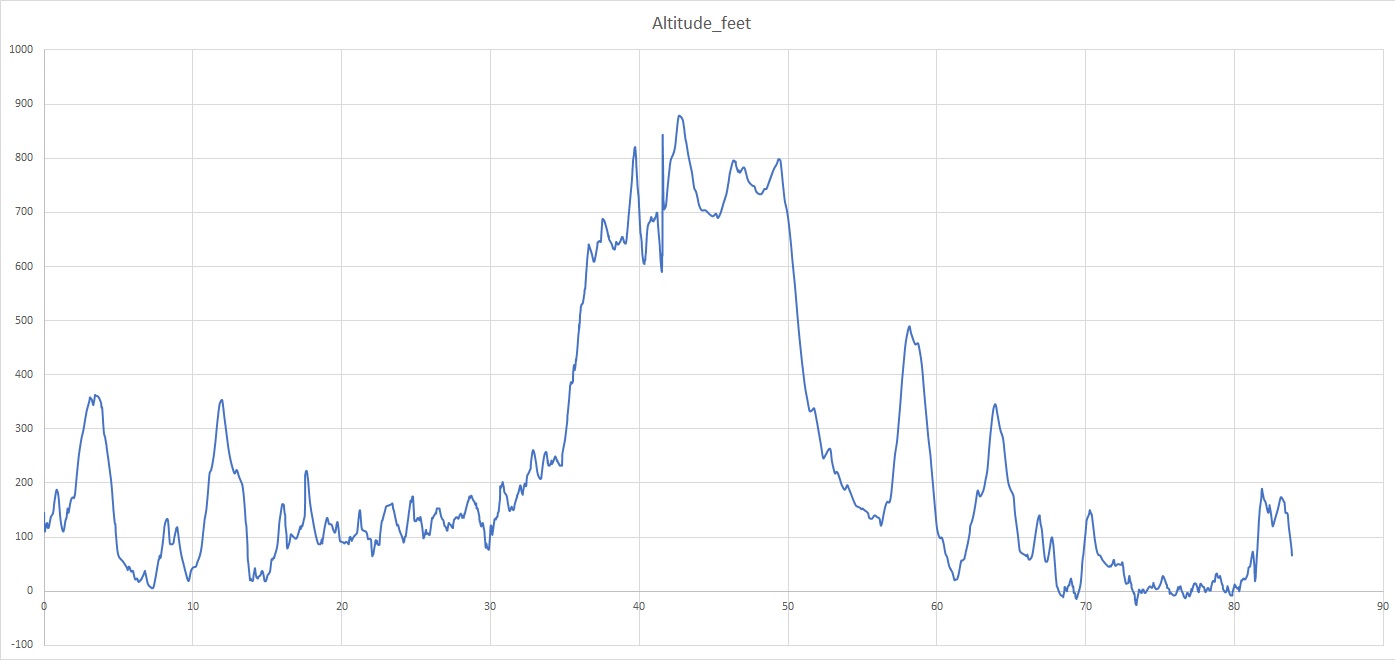
Elevations for this ride so you can predict how cold you may get or if you may need to take breaks for altitude changes. Y Axis is altitude feet, X Axis is Miles travelled: